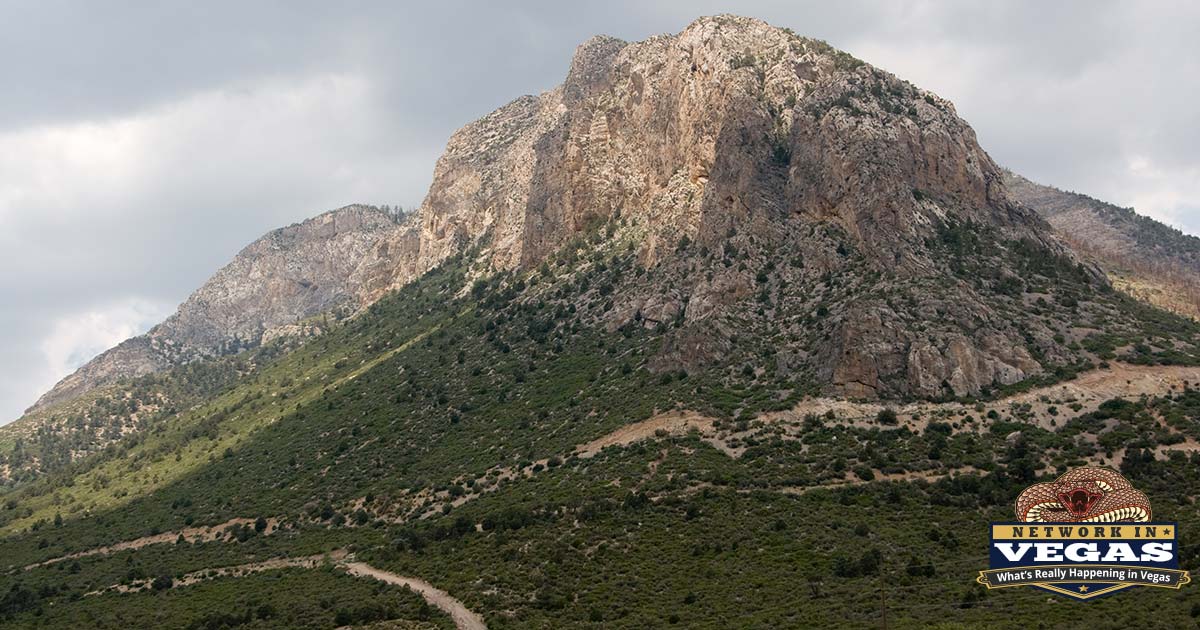
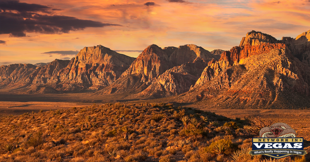
Meta description: Red Rock Canyon sits 17 miles from the Strip and packs 26 miles of hiking trails, world-class rock climbing, and a 13-mile scenic drive. Here’s how to visit in 2026, including the timed-entry reservation system, fees, and the trails actually worth your time.
Seventeen miles west of the Strip, the pavement ends at a 3,000-foot wall of banded sandstone. Red Rock Canyon National Conservation Area is the reason locals put up with August in Las Vegas: 195,000 acres of Mojave Desert, a 13-mile scenic drive, and some of the best sandstone climbing in North America, all close enough that you can hike a canyon in the morning and be back at a blackjack table by noon.
Red Rock became Nevada’s first National Conservation Area in 1990, and it now draws over three million visitors a year. That popularity changed how you visit. Since October 2023, the Bureau of Land Management requires timed-entry reservations for the Scenic Drive during the busy season, and showing up without one between 8 AM and 5 PM from October through May means getting turned around at the fee station. So before we get to the trails, the logistics.
Fees, Reservations, and Hours (2026)
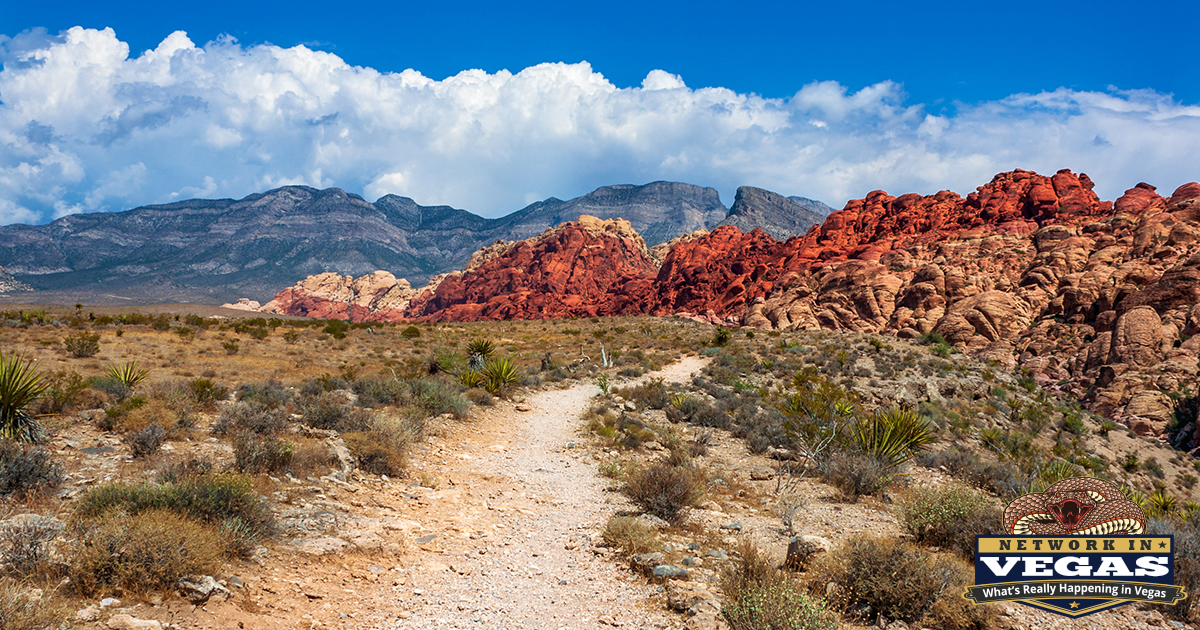
Entry fees: $20 per car or truck, $10 per motorcycle, $8 per bicycle, and $5 if you walk in. A Red Rock Annual Pass runs $50, and the $80 America the Beautiful pass covers Red Rock along with every other federal fee site in the country. If you plan to visit more than twice a year, the annual pass pays for itself on the third trip. Seniors 62 and up can get a lifetime America the Beautiful pass for $80 or an annual version for $20, and active military, veterans, and Gold Star families get in free with proof of eligibility.
Timed-entry reservations: Required for vehicles entering the Scenic Drive between 8 AM and 5 PM, October 1 through May 31. Book at Recreation.gov (there’s a $2 booking fee on top of the entry fee) or by calling 877-444-6777. Reservations open 30 days in advance at 7 AM, and you get a one-hour arrival window. Once you’re in, you can stay until the drive closes.
A few things trip people up:
- The Scenic Drive is a one-way loop. Once you’re on it, there’s no turning around, and re-entering after you exit requires a new reservation.
- Cell service dies near the entrance. Download or print your reservation before you leave town.
- Weekend morning slots in spring sell out one to two weeks ahead. Weekdays are usually available within a day or two.
- Cyclists, pedestrians, and motorcycles don’t need reservations. Neither do vehicles arriving before 8 AM or after 5 PM (when the drive is still open). Beating the 8 AM cutoff is the standard local move, and it happens to be the best time to hike anyway.
- Reservations aren’t needed at all from June 1 through September 30. Summer heat handles crowd control on its own.
Scenic Drive hours shift with the season: 6 AM to 5 PM November through February, 6 AM to 7 PM in March and October, and 6 AM to 8 PM April through September. The Visitor Center is open daily from 8 AM to 4:30 PM, and it’s worth a stop. It has the only flush toilets and water refill stations in the conservation area, plus a tortoise habitat, geology exhibits, and rangers who know current trail conditions.
Free alternative: Calico Basin, just north of the main entrance off NV-159, sits outside the fee gate. No reservation, no charge, and access to the Kraft Mountain area and Red Spring boardwalk. It’s a legitimate backup when the Scenic Drive is booked solid.
The 13-Mile Scenic Drive
The drive itself is the default Red Rock experience, and plenty of visitors never leave their car. It takes about 40 minutes without stops, but budget two to three hours because you’ll stop. The Calico Hills overlooks in the first two miles are the postcard shot: swirled red-and-cream Aztec sandstone that glows at sunrise. Sandstone Quarry at mile 2.5 marks an old 1900s stone-cutting operation, with abandoned blocks still sitting where the quarrymen left them. The High Point Overlook at mile 4.7 gives you the full sweep of the escarpment on one side and the Las Vegas valley on the other.
The drive is also a serious road-cycling route, a steady climb to High Point followed by a long descent, and you’ll share the road with pace lines most mornings. Drive accordingly.
The Geology, Briefly
The colors that give Red Rock its name come from iron oxide in 180-million-year-old Aztec sandstone, the fossilized remains of a Jurassic dune field. The gray limestone stacked on top of it along the escarpment is far older, around 500 million years, and it sits above the younger rock because of the Keystone Thrust fault, which shoved the older layer up and over the sandstone about 65 million years ago. It’s one of the most visible thrust faults anywhere, and there’s a trail that takes you right to the contact line.
Humans have used these canyons for thousands of years. The Southern Paiute, Chemehuevi, and Western Shoshone peoples all have deep connections to this land, and you can still see petroglyphs, pictographs, and agave roasting pits at several sites, most easily near Willow Springs. Look, photograph, and leave them alone. Touching rock art damages it, and climbers are required to stay at least 50 feet from any archaeological site.
The Trails
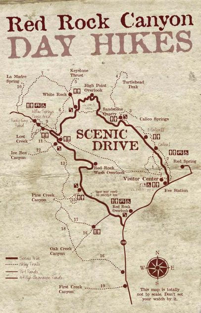
Red Rock has 26 miles of designated trails spread across roughly two dozen routes, from stroller-friendly loops to a 2,000-foot scramble up a limestone peak. Distances below are round trip. One universal note: these are real desert hikes. Carry more water than you think you need (a liter per hour in warm weather), and remember there’s no water anywhere on the Scenic Drive except the Visitor Center.
Moenkopi Loop
2 miles | 1.5 hours | Easy
Starts right at the Visitor Center, which makes it the natural first hike and the one rangers use for guided morning walks. The trail crosses open desert and a limestone ridge dotted with Triassic-era fossils, with wide views of the Wilson Cliffs the whole way. Moenkopi is a Hopi word meaning “place of running water,” which is optimistic, but the wildflowers in March and April are real.
Calico Hills
2 to 6 miles | 1.5 to 3.5 hours | Moderate
Runs along the base of the Calico Rocks between Calico Basin and Sandstone Quarry, and you choose your distance by where you park: either Calico overlook lot, the fee station lot, or Sandstone Quarry. This is the trail for wandering. The red sandstone invites scrambling, and half the fun is leaving the path to poke around the slickrock (just remember where the trail is).
Calico Tanks
2.5 miles | 2 hours | Moderate
The best moderate hike in the park, and it knows it; the Sandstone Quarry lot fills early. The route climbs through a sandy wash and up natural sandstone steps to a hidden water pocket, a “tank” that holds rainwater much of the year. Keep going 50 feet past the tank and you get the payoff: a framed view of the entire Las Vegas valley, Strip included. Good for families with kids old enough to handle some rock hopping.
Turtlehead Peak
5 miles | 4 to 5 hours | Strenuous
The hardest maintained route in Red Rock and the one to pick if you want to earn your dinner. From Sandstone Quarry the trail climbs roughly 2,000 feet to the summit of the gray limestone dome that looms over the Calico Hills. The upper section is a loose, steep scramble where the “trail” becomes a suggestion, so wear real shoes and bring double the water. The summit view covers the entire conservation area, the valley, and on clear days, Lake Mead. Not for anyone uneasy about route-finding.
Keystone Thrust
2.2 miles | 1.5 hours | Moderate
The geology hike. From the upper White Rock lot, the trail climbs to the exact spot where 500-million-year-old gray limestone sits directly on top of 180-million-year-old red sandstone. Even if plate tectonics isn’t your thing, the color contrast at the fault line is striking, and the trail is quieter than anything in the Calico area.
White Rock to Willow Springs
4.4 miles | 2.5 hours | Easy to Moderate
A pleasant point-to-point (or out-and-back) through the pinyon-juniper zone at the base of White Rock Mountain. The side trail near the start descends to a guzzler, a man-made water catchment that concentrates wildlife. Dawn and dusk hikers regularly spot bighorn sheep here. This is also where Red Rock stops feeling like bare desert; the elevation brings actual trees.
White Rock / La Madre Spring Loop
6 miles | 3.5 hours | Moderate
The full circuit around White Rock Mountain, and the best half-day loop in the park. You get everything: open desert, sandstone views, shady canyon, and the spring itself, a rare year-round water source that supports a small riparian pocket. Because of the distance, it’s noticeably less crowded than anything shorter. Start early and go clockwise to get the exposed section done before the sun is high.
Lost Creek / Children’s Discovery Trail
0.75 miles | 1 hour | Easy
The best hike in Red Rock for kids, full stop. Grab the free Children’s Discovery Trail guide at the Visitor Center first. The loop packs a rock tunnel, boardwalks, pictographs, agave roasting pits, and, from roughly late winter through spring, a seasonal waterfall into less than a mile. Local schools run field trips here for a reason. Go on a weekday if you can; weekend mornings get busy.
Willow Springs Loop
1.5 miles | 1.25 hours | Easy

Starts at the Willow Springs picnic area and passes a pictograph site and prehistoric roasting pits on its way to the Lost Creek lot. Pair it with the Children’s Discovery Trail for an easy archaeology-focused morning. The short Petroglyph Wall trail, barely a tenth of a mile from the same picnic area, is right here too and shouldn’t be skipped.
La Madre Springs
3.3 miles | 2 hours | Moderate
Follows an old roadbed up a canyon with red and white sandstone on one side and gray limestone on the other. The road ends at a small dam below the spring; the spring itself is fenced off to protect the water source and the wildlife that depends on it. Bring binoculars. This drainage is one of the more reliable places to see bighorn sheep in the entire conservation area.
SMYC Trail
2.2 miles | 2 hours | Moderate
A connector trail linking Willow Springs to Ice Box Canyon along the base of the escarpment (the name comes from the Spring Mountain Youth Camp, whose crews helped build it). On its own it’s an unremarkable but pretty traverse. Its real value is combining canyons: hike Ice Box, take SMYC north, and come back through Lost Creek without moving your car.
Ice Box Canyon
2.6 miles | 2.5 hours | Moderate
A local favorite, and the trail to pick on a hot day. The canyon’s high walls block direct sun for most of the day, keeping it 10 to 15 degrees cooler than the open desert, hence the name. The route crosses open desert, then funnels into the canyon where the maintained trail dissolves into boulder scrambling. After winter rains or snowmelt, a waterfall pours off the back wall. Ponderosa pines grow at the canyon mouth, trees you’d otherwise have to drive to Mt. Charleston to see.
Dale’s Trail
4.4 miles | 2.5 hours | Moderate
A 2.2-mile segment of the Escarpment Route running through open desert beneath the Wilson Cliffs, connecting Ice Box Canyon to Pine Creek. Like SMYC, it’s a linker: quiet, exposed, with constant views of the 3,000-foot sandstone wall to the west. Best in cool weather, since there’s zero shade.
Pine Creek Canyon
3 miles | 2 hours | Easy to Moderate
One of the prettiest walks in the park. The trail descends across open desert toward the canyon mouth, following a seasonal creek to the foundation of the Wilson homestead, built in the 1920s and marked now by concrete footings and the ponderosa pines the family planted. Push into the canyon past the homestead and you’ll find creek crossings, big pines, and towering walls that draw climbers from everywhere. The approach is easy; the canyon itself gets rougher the deeper you go.
Fire Ecology Trail
0.75 miles | 45 minutes | Easy
A short figure-eight loop into Pine Creek Wash through the site of a 1997 controlled burn, done to protect the wash’s ponderosa pines from a future catastrophic fire. Interpretive signs explain how fire shapes the desert. Little burn evidence remains, which is rather the point. A good add-on to Pine Creek rather than a destination itself.
Oak Creek Canyon
2 miles | 1.5 hours | Easy to Moderate
The quiet one. Oak Creek gets a fraction of the traffic of Pine Creek or Ice Box despite offering the same formula: an open desert approach with escarpment views, then a boulder-filled canyon that gets more rugged the farther you push. Accessed from a gravel spur near the end of the Scenic Drive, or from a trailhead on NV-159 outside the fee area. If crowds at the popular canyons annoy you, this is your answer.
Arnight Trail
2.4 miles | 1.5 hours | Moderate
Another Escarpment Route segment, running from the Oak Creek trailhead toward Pine Creek beneath the Wilson Cliffs. Serious hikers chain Arnight, Dale’s, and SMYC into a single long traverse of the escarpment base, one of the better big days in the park when the weather is cool.
Knoll Trail
3.5 miles | 2.5 hours | Moderate
An open-desert route toward a low ridge scattered with boulders that make a natural lunch spot. This is the wildlife-watching hike: white-tailed antelope ground squirrels (routinely mistaken for chipmunks) posting sentry duty in the cholla, plus juniper titmice, western bluebirds, scrub-jays, and ravens. Bring the binoculars and go slow.
First Creek Canyon
3 miles | 2 hours | Easy to Moderate
Starts from a roadside trailhead on NV-159 south of the Scenic Drive exit, which means no reservation and no fee. The flat, well-maintained trail crosses a desert valley to a small seasonal waterfall shaded by cottonwoods and willows, a genuine oasis when the water’s running in late winter and spring. Only the last few feet require any scrambling. One of the best effort-to-reward ratios in the park.
Beyond Hiking
Rock climbing. Red Rock is one of the premier climbing destinations in the United States, with thousands of routes from single-pitch sport climbs at Calico Basin to 1,500-foot traditional lines on the escarpment. Climbers planning long routes should get a Late Exit Pass through Recreation.gov, which allows you to stay up to two hours past closure; without it, a slow descent earns you a citation. The prime season runs October through April.
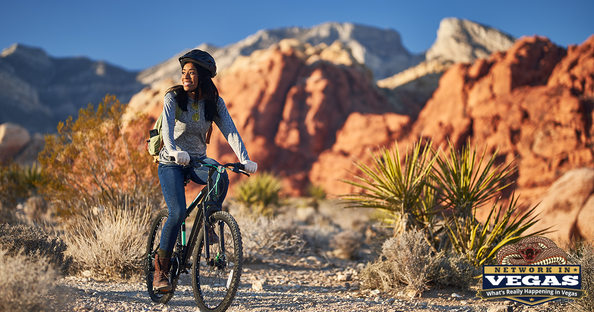
Cycling. The Scenic Drive climb is a rite of passage for Vegas road cyclists, and no reservation is required on a bike. Mountain bikers head to the Cottonwood Valley trail network off NV-160, just south of the conservation area.
Camping. The Red Rock Campground on Moenkopi Road, about two miles east of the Visitor Center, is open September 1 through May 31 by Recreation.gov reservation and closes entirely for summer. Dispersed camping is allowed year-round off Lovell Canyon Road near Mountain Springs.
Wildlife. Over 200 species live here: desert bighorn sheep on the high limestone, wild burros along NV-159 (do not feed them, it’s illegal and it gets them killed on the road), desert tortoises, coyotes, bobcats, kit foxes, red-tailed hawks, golden eagles, and hummingbirds around any water source. The burros you’ll see without trying. The bighorns take luck and early mornings.
Ranger programs. The Southern Nevada Conservancy and BLM run a full calendar out of the Visitor Center: sunrise hikes on Moenkopi, bat walks at Red Springs, blacklight scorpion hunts on summer nights, and full-moon hikes. Most are free with entry, and the scorpion hikes book out fast.
When to Go
October through April is prime season: highs in the 50s to 70s, cold mornings, and the reservation requirement. March and April add wildflowers and seasonal waterfalls but also the year’s biggest crowds. Summer means 100-plus-degree afternoons and empty trails; hike at 6 AM when the drive opens, be done by 10, or come for an evening ranger program. Winter occasionally dusts the escarpment with snow, which against the red sandstone is worth rearranging a morning for.
Getting There
From the Strip, take Charleston Boulevard (NV-159) west for about 17 miles; the fee station is on your right past Calico Basin. From Summerlin or the 215 Beltway, exit at Charleston and head west. There’s no public transit to the main entrance, so it’s your car, a rental, a tour, or a rideshare (note that commercial vehicles, rideshares included, pay $20 plus $5 per person).
The drive from the middle of the Strip takes 25 to 35 minutes. That’s the whole pitch, really. The most visited conservation area in the country, with Jurassic sandstone, bighorn sheep, and canyons that stay cool in July, sits closer to your hotel than the airport does.
Entry fees, hours, and reservation rules are current as of July 2026. Check Recreation.gov or the BLM’s Red Rock Canyon page before you go, and call the Visitor Center at (702) 515-5350 with questions.