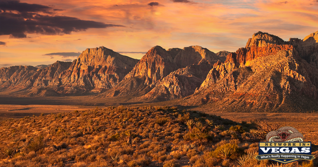
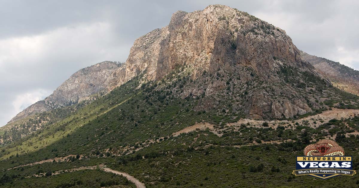
When it’s 112 degrees on the Strip, it’s 78 at the Mt. Charleston trailheads. That single fact explains why half of Las Vegas seems to be driving up Kyle Canyon Road on any given July Saturday. Charleston Peak tops out at 11,916 feet, high enough to hold snow into late spring while the valley below bakes, and the whole area sits under an hour from your driveway. You can leave a casino parking garage and be standing in a ponderosa pine forest before your car’s air conditioning fully kicks in.
Locals call the whole area “Mt. Charleston,” but the correct name for the region is the Spring Mountains National Recreation Area, part of the Humboldt-Toiyabe National Forest. It covers 316,000 acres of terrain that has almost nothing in common with the desert floor: aspen groves, seasonal waterfalls, bristlecone pines older than the Roman Empire, and a handful of plant and animal species that exist nowhere else on Earth. That last part isn’t marketing copy. The mountain is what biologists call a “sky island,” a patch of alpine habitat cut off from every other mountain range by miles of Mojave Desert, and life up there has been evolving on its own terms for thousands of years.
Here’s what to do, where to go, and how to avoid the mistakes that first-timers make every weekend.
Know Your Canyons: Kyle vs. Lee
The mountain has two main access points, and understanding the difference will save you from ending up in the wrong place.
Kyle Canyon (State Route 157) is the busier of the two and home to the small residential community of Mt. Charleston, the cabins, The Retreat on Charleston Peak hotel, and most of the popular trailheads: Mary Jane Falls, Cathedral Rock, Trail Canyon, Fletcher Canyon, and Echo. If someone tells you they “went to Mt. Charleston,” they probably went here.
Lee Canyon (State Route 156) sits a few miles north and is where you’ll find the Lee Canyon ski resort, the Bristlecone Trail, and the Sawmill and McWilliams areas. In winter, this is where the skiing and most of the sanctioned sledding happens.
The two canyons connect via Deer Creek Road (State Route 158), a nine-mile stretch that’s worth driving even if you have no destination. It’s one of the prettiest roads in Southern Nevada, and the Desert View Overlook along the way gives you a panorama of the desert floor you just escaped. On a clear day you can watch heat shimmer over the valley while standing in a breeze that requires a jacket.
Hiking: The Main Event
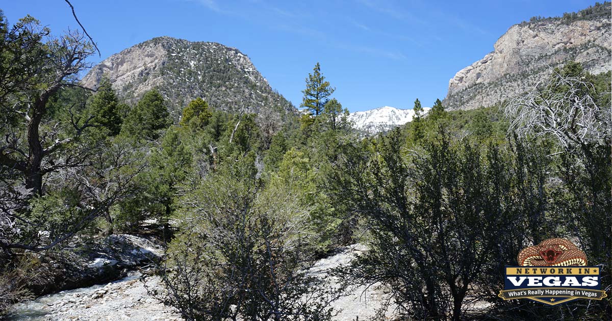
Hiking is the reason most people come up, and the trail selection runs from stroller-friendly walks to one of the toughest day hikes in Nevada.
Fletcher Canyon (3.4 miles round trip, gentle grade) is the best easy hike in Kyle Canyon. The trail follows a wash into a narrowing slot between limestone walls, and it’s shaded for much of its length. Good with kids, good as a first hike at altitude.
Mary Jane Falls (roughly 3 miles round trip, about 1,000 feet of gain) is the most popular trail on the mountain, and the parking lot proves it. A series of steep switchbacks climbs to a seasonal waterfall and shallow caves at the base of a towering cliff. Go in late spring or early summer when snowmelt feeds the falls; by August it’s often a trickle. Arrive before 8 a.m. on weekends or you’ll be parking a half mile down the road.
Cathedral Rock (2.8 miles round trip, close to 1,000 feet of gain) is my pick for the best effort-to-payoff ratio on the mountain. It’s short but steep, passing a seasonal waterfall and climbing through aspens to a rocky summit that looks straight down Kyle Canyon. Sunset from the top is spectacular, just bring a headlamp for the way down. Note that the trailhead parking fills fast because it also serves the Griffith Peak route.
Bristlecone Trail (6-mile loop) in upper Lee Canyon is the one to pick when you want distance without brutal climbing. The loop wanders through stands of bristlecone pine, the gnarled, half-dead-looking trees that are among the oldest living things on the planet. It’s also one of the few trails up here where mountain bikes are allowed.
Raintree via the North Loop Trail (about 6 miles round trip, steady climbing) takes you to the mountain’s most famous single tree, a massive bristlecone estimated at around 3,000 years old. It was alive before Rome was founded. Continue a short distance past it and you reach Mummy Springs, a rare year-round water source.
Griffith Peak (9.7 miles round trip, strenuous) climbs from the Cathedral Rock lot through ponderosa, white fir, and aspen to an 11,060-foot summit with some of the best views in the state. Parking is the crux: the lot is often full by 6:30 a.m. on summer weekends.
Charleston Peak itself is the big prize, and it’s a serious undertaking: 17 to 20 miles depending on the route, with over 4,000 feet of gain, usually done as a loop combining the South Loop and North Loop trails. Snow lingers on the upper sections into June most years, and afternoon thunderstorms in July and August make an early start non-negotiable. Fit hikers do it in 8 to 12 hours. Along the way you’ll pass wreckage from a 1955 plane crash near the summit ridge, which brings us to a piece of history most visitors never hear about.
The Cold War Secret on the Summit
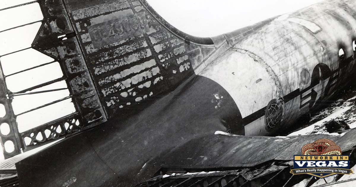
In November 1955, a C-54 transport crashed into Charleston Peak in a snowstorm, killing all 14 aboard. The passengers were scientists and security personnel working on the top-secret U-2 spy plane program at Area 51, and the government kept the crash classified for decades. Families weren’t told what their relatives had been doing or where they died.
The story finally became public in the 2000s, and today the Silent Heroes of the Cold War National Memorial at the Spring Mountains Visitor Gateway honors the victims. It’s the first national memorial dedicated to Cold War casualties. The Visitor Gateway itself, on Kyle Canyon Road before you reach the village, opened in 2015 and is worth a stop on your first visit: trail maps, current conditions, rangers who actually know the answers, plus a picnic area and short interpretive walks.
Summer at Lee Canyon: No Snow Required
Lee Canyon used to shut down when the snow melted. Not anymore. The resort has rebuilt itself into a year-round operation, and the summer side keeps growing.
The headliner is the downhill mountain bike park, the only lift-served bike park in Southern Nevada. Chairlifts haul you and your bike to the top, and purpose-built trails bring you down, from beginner flow trails to double-black descents. The 2026 season opened on May 1, the earliest start in the resort’s history after a warm March ended the ski season ahead of schedule. Rentals and lessons are available, so you don’t need to own a downhill rig to try it. Kids 12 and under ride free with the Power Kids pass.
Beyond biking, the resort runs scenic chair rides on the Bristlecone Skyway, mountainside yoga on Friday and Sunday mornings, and the free Music on the Mountain concert series through the summer (admission is free; parking is $20 unless you have a same-day lift or bike ticket). The one to circle on your calendar is Stars on the Summit, a stargazing night held at 9,300 feet atop the Bluebird chairlift with the Las Vegas Astronomical Society. At that elevation, far above the valley’s light dome, the sky looks nothing like it does from town.
Winter: The Closest Skiing to Las Vegas
From roughly December through March, Lee Canyon becomes a proper ski resort, with around 30 runs, terrain parks, and a base elevation of 8,510 feet. It’s not Park City and doesn’t pretend to be, but for a place 45 minutes from the Strip, the skiing is legitimately fun, and midweek lift tickets cost a fraction of what the destination resorts charge. Rentals, lessons, and tubing are all on site.
Sledding is where things get chaotic. After a fresh snowfall, thousands of valley residents head up the mountain at once, and both canyon roads can back up for miles. The designated snow play areas are Lee Meadows along SR 156 and the Foxtail Snow Play Area, which requires a reservation in peak season. A few hard-earned rules: chains or 4WD are often required and enforced by NHP checkpoints, there are no gas stations anywhere on the mountain, and cell service is spotty. Fill your tank in town, bring warm clothes and food, and go on a weekday if you possibly can.
The Lodge, the Cabins, and Where to Stay
For nearly 60 years, the A-frame Mt. Charleston Lodge at the top of Kyle Canyon was the mountain’s living room: the place for a hot toddy after a hike, a plate of food by the fireplace, and one of the best patio views in Nevada. It burned down in September 2021, and the loss hit locals hard.
The good news: it’s coming back. Construction on the new lodge began in January 2026. The rebuild, owned by the Ellis family of Ellis Island Casino fame and designed by Steelman Partners (the firm behind Resorts World and Circa), keeps the two-story A-frame silhouette at roughly 11,000 square feet, with an expanded restaurant, outdoor patio, and a bi-level parking structure. No opening date has been announced yet, but the lodge’s website promises a grand reopening. The 23 log cabins next door survived the fire and never closed; they remain the classic overnight option, with fireplaces and jetted tubs at 7,700 feet.
The other lodging option is The Retreat on Charleston Peak, a full-service hotel lower in Kyle Canyon with a restaurant, bar, and seasonal pool. It’s the practical choice for groups and the only place to get a sit-down meal on the mountain until the lodge reopens.
Camping is the budget play. Fletcher View and Kyle Canyon campgrounds serve the Kyle side; McWilliams and Dolomite sit in upper Lee Canyon near the Bristlecone trailhead. All are reservable on Recreation.gov and book out weeks ahead for summer weekends. The Old Mill Picnic Area is the day-use favorite for families who want tables, shade, and short walks without a full hike.
The Wildlife You Won’t See Anywhere Else
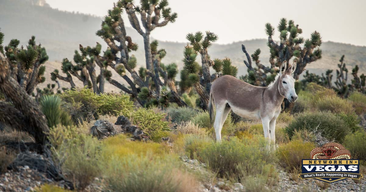
The sky-island isolation produced some genuine oddities. The Mt. Charleston blue butterfly, a tiny federally endangered species, lives only in the high meadows of the Spring Mountains and nowhere else on the planet. The Palmer’s chipmunk is likewise found only here. Wild burros wander the lower canyons and will absolutely approach your car; feeding them is illegal, bad for the animals, and the reason a few get hit by cars every year. Keep driving.
You may also see mule deer, plenty of wild horses near the SR 156/158 junction, and, rarely, elk or a bobcat. The bristlecone pines deserve a mention here too: some individuals in the Spring Mountains have been standing for two to three thousand years, surviving precisely because they grow where almost nothing else can.
Practical Tips That Actually Matter
A few things that separate a great day from a miserable one:
- Go early. Trailhead lots at Mary Jane Falls, Cathedral Rock, and Echo fill by mid-morning on weekends, sometimes by 6:30 a.m. Overflow parking means road walking.
- Respect the altitude. Trailheads start around 7,000 to 8,500 feet. If you live at valley elevation, you’ll feel it. Drink more water than you think you need and pace yourself the first hour.
- Pack layers year-round. A 75-degree afternoon becomes a 50-degree evening fast, and summer monsoon storms roll in with little warning. Off the peaks by early afternoon in July and August.
- Fuel up in town. No gas stations exist on the mountain. The last reliable stops are along US-95.
- Check fire restrictions. Campfire and charcoal rules change through the summer, and they’re enforced.
- Cell coverage is unreliable. Download maps before you leave the highway.
Getting There
From Las Vegas, take US-95 North about 17 miles past the Kyle Canyon exit signs, then turn left onto SR 157 / Kyle Canyon Road for the village, cabins, and most trailheads. For Lee Canyon and the ski resort, continue on US-95 a few more miles and turn left onto SR 156. Deer Creek Road (SR 158) links the two, so an easy first visit is a loop: up Kyle, across Deer Creek with a stop at the overlook, down Lee, and back on the 95. Door to door from the Strip, figure 45 minutes to an hour each way.

That loop, plus one short hike and lunch at the Retreat, is the perfect introduction. After that, you’ll understand why people who’ve lived in Vegas for decades still make the drive every summer, and why the return trip down the canyon, watching the thermometer climb ten degrees every few minutes, always feels a little like a punishment.